When Gods Were Tourists: Greece’s Sacred Travel Hubs
Before passports and package tours, pilgrims...


The Sacred Way in the Kerameikos Cemetery; view from Pireos Street.
When we think of Greece’s myriad archaeological ruins, our minds usually drift to marble temples, hilltop citadels, and ancient theaters. Yet some of the country’s most remarkable monuments are far less conspicuous. They wind through olive groves, climb mountain passes, skirt Bronze Age fortresses, and slip quietly into modern villages. They are the roads, tracks, and pathways of antiquity.
Unlike sprawling palaces or sanctuaries, roads were never built to impress. Their purpose was purely functional: to connect people and places. Traders carrying precious cargo, pilgrims bound for sacred shrines, diplomatic envoys moving between rival city-states, and armies marching to war all relied on these routes through Greece’s rugged landscape.
And while the societies that created them have long since faded, some of these roads never truly fell out of use. Ancient highways became mule tracks, shepherds’ paths, village lanes, and, more recently, some of Greece’s most rewarding hiking trails.
Here are seven roads that once formed vital arteries of movement in early Greece, and – at least in part – can still be walked today.

The Royal Road of Knossos is often described as Europe’s oldest paved road.
© Shutterstock
If roads could boast, the Royal Road of Knossos would have a strong claim to being Europe’s oldest. Built during the height of Minoan civilization more than 3,500 years ago, it formed the principal approach to the Palace of Knossos, linking the great ceremonial center with the surrounding settlements and the port beyond (near modern-day Iraklion). It was also part of a wider network of roads that stitched together the major centers of Bronze Age Crete, including Gortyn and the island’s southern coast, stretching some 50km.
Far from a simple track, this was a carefully engineered roadway. Nearly four meters wide in places, it was built on a layered foundation of clay, gypsum mortar, and compacted sandstone gravel, topped in sections by a central paved strip of basalt flagstones that helped guide movement toward the palace. Archaeologists have also identified sophisticated drainage channels designed to carry rainwater away from the surface – an elegant solution that helps explain how parts of the road have survived for millennia.
Today, visitors to Knossos can still walk beside and across surviving stretches of the road on the western side of the site. The best-preserved section leads toward the Theatral Area, a stepped open space where archaeologist Sir Arthur Evans imagined ceremonial processions arriving along what he famously described as a “sacred way.” Whether those processions carried priests, rulers, or offerings, the route clearly served as a formal entrance to one of the Bronze Age Mediterranean’s most important centers.
Legend adds another layer of intrigue. According to later tradition, King Minos himself traveled from Knossos into the mountains to consult his divine father Zeus at the sacred cave of “Dikteon Andron,” receiving guidance and laws for his kingdom. Myth or history, the story neatly captures the road’s deeper significance: it was not merely a route between places, but a link between the human and divine worlds of Minoan Crete.

The Arkadiko Bridge, located near the modern road from Tiryns to Epidauros, is the oldest preserved bridge in Europe.
By the latter half of the second millennium BC, the center of gravity in the Aegean had shifted to the Greek mainland, where the Mycenaeans were busy carving monumental roads in the hills of the northeastern Peloponnese. Built during the Late Bronze Age, these routes connected the great citadels of Mycenae and Tiryns with ports, settlements, and strategic gateways across the Argolid and the world beyond. Recent research using digital terrain modelling has shown just how carefully these roads were planned, with routes engineered to move wheeled vehicles – carts, wagons, and war chariots – efficiently through the landscape.
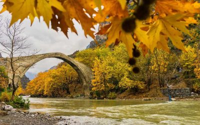
Several stretches survive today. The most impressive follows the modern road between Tiryns and Epidaurus, where visitors can still walk sections of the ancient route. Along the way stands the arched Arkadiko Bridge, a Cyclopean structure built sometime around 1300 BC. Constructed from huge limestone blocks without mortar, it is widely regarded as the oldest surviving bridge in Europe and, remarkably, remains passable today. Nearby lie the remains of several other Mycenaean bridges, evidence of a surprisingly sophisticated transport network.
Another surviving route, known to archaeologists as the M1 Road, once led out from the citadel of Mycenae toward the Berbati Valley and the coast – possibly to the harbor at Kalamianos, on the Saronic Gulf. Although its ultimate destination remains debated – one early hypothesis is that it led to Corinth – the road hints at a wider system designed to support a bustling Bronze Age economy, and may have even served a ritual function.

Known as the Sacred Way (“Iera Odos”), this road carried thousands of initiates taking part in the famed Eleusinian Mysteries, the secret religious rites dedicated to Demeter and Persephone.
For over a thousand years – some say as early 1500 BC to 392 AD – one of the most important journeys in the ancient Greek world began at the Sacred Gate in Athens and ended 21km away at Eleusis. Known simply as the Sacred Way (“Iera Odos”), this road carried thousands of initiates taking part in the famed Eleusinian Mysteries, the secret religious rites dedicated to Demeter and Persephone. Emperors, philosophers, statesmen, and ordinary pilgrims all walked the same route, united by the promise of a spiritual revelation at the journey’s end.
The procession departed from the Kerameikos cemetery and wound westward through the Attic countryside, pausing at shrines, bridges, and sacred landmarks along the way. Among the most important stops were the crossing of the Cephissus River and the sanctuary of Apollo at Daphni, near the 6th-century Byzantine monastery that still stands beside the ancient route.
Much of the ancient road now lies beneath modern road from central Athens to Aigaleo and Haidari (the old route to Eleusis), still signposted as the “Iera Odos,” but traces survive. Visitors can see the remains of the Sacred Gate in the Kerameikos archaeological site, while a section of the ancient paving was uncovered near Aigaleo during construction of the Athens Metro. The modern road broadly follows the same course all the way to Eleusis, where the processional road continues through the sanctuary itself, leading toward the great Telesterion, the hall where the Mysteries were performed.

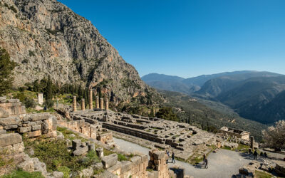
View of the Athenian Treasury at Delphi, with the Stoa of the Athenians on the right.
If Eleusis offered initiates a glimpse of the next world, Delphi promised guidance in this one. Perched on the slopes of Mount Parnassus, the sanctuary of Apollo was regarded by the ancient Greeks as the center of the world, marked by the sacred Omphalos, or “navel stone.” Pilgrims travelled here from every corner of the Mediterranean seeking the wisdom of the Pythia, Apollo’s priestess, whose cryptic pronouncements could influence everything from colonization ventures to declarations of war.
At the heart of the sanctuary was the Sacred Way (again, “Iera Odos”), a winding processional road that climbed steadily uphill toward the Temple of Apollo. For modern visitors, it remains one of the highlights of a visit to Delphi, lined with treasures and altars, some bearing inscriptions and dedications. Today, visitors can follow the same stone-paved path that countless pilgrims, ambassadors, generals, and kings once trod on their way to consult the oracle.
The route was deliberately theatrical. As visitors ascended the hillside, they passed an extraordinary display of monuments, statues, and votive offerings dedicated by cities from across the Greek world, including the Treasury of the Athenians and the Spartan naval victory monument. The road twists and turns between these monuments before arriving at the Temple of Apollo itself, creating a carefully choreographed journey designed to inspire awe long before the oracle was reached.
The Sacred Way formed the final stage of a much larger network of roads that connected Delphi with central Greece and beyond. Pilgrims arrived from every corner of the ancient Mediterranean, but regardless of where their journey began, it ended here, on this steep mountain path beneath the cliffs of Parnassus.
More than two millennia later, it remains one of the few places in Greece where visitors can retrace an entire sacred journey almost exactly as an ancient pilgrim would have experienced it – climbing toward the place the Greeks believed stood at the very center of their world.
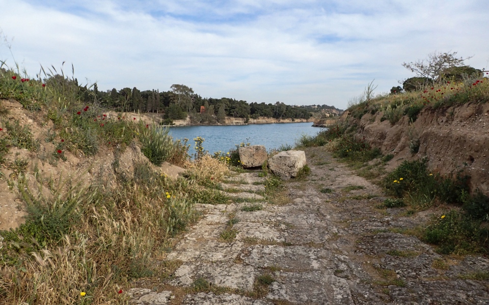
A preserved section of the ancient trackway, which ran for more than 8 kilometers across the Isthmus of Corinth.
Now, strictly speaking, the Diolkos was not a road in the traditional sense but, for centuries, it formed one of the most important links in the ancient Greek transportation network, allowing ships, cargo, and people to bypass the treacherous voyage around the Peloponnese.
Constructed around 600 BC, probably during the rule of the Corinthian tyrant Periander, the Diolkos – a compound of the Greek words dia (meaning “across”) and holkos (“portage machine”) – was a paved trackway that crossed the narrow Isthmus of Corinth. Rather than sailing the long and often dangerous route around Cape Malea, vessels could be unloaded – or in some cases hauled intact on wheeled cradles – across the 8-kilometer corridor separating the Corinthian and Saronic Gulfs.
Ingeniously engineered, the stone-paved route featured parallel grooves cut into limestone blocks that guided the wheeled platforms carrying ships overland. In effect, it functioned as a kind of ancient railway more than two millennia before the arrival of steam locomotives. The system transformed Corinth into one of the Mediterranean’s most important commercial hubs and played a strategic role during times of war, when the rapid movement of ships could provide a crucial advantage. Indeed, the effective use of the Diolkos in antiquity prompted 5th century BC comic playwright Aristophanes to coin the phrase “as fast as a Corinthian.”
Visitors can still see surviving sections of the Diolkos near the western entrance of the modern Corinth Canal, where stretches of the original stone paving and guide grooves remain visible beside the water. Around 1,100 meters of its original 8-kilometer course is visible, and the Ministry of Culture is overseeing major restoration works. As of July 2025, a footpath alongside a stretch of the Diolkos is open for visitors.
More than any other route on this list, the Diolkos reminds us that the roads of ancient Greece were not always built for people. Sometimes, they were built for ships!

The incomplete archaic “kouros,” close to Apollonas village, Naxos.
© Shutterstock
For centuries, the island of Naxos supplied some of the finest marble in the ancient Mediterranean. Its brilliant white stone was used to create statues, temples, and monuments across the Greek world, including dedications at Delos and Delphi. Getting those enormous blocks from quarry to ship, however, required a transportation network of its own.
In the marble-producing districts of Flerio and Apollonas, ancient quarry workers carved pathways and hauling routes into the landscape, dragging partially worked sculptures and stone blocks down from the mountains toward waiting vessels on the coast. The risks were considerable. At Flerio, near the village of Melanes, visitors can still see two unfinished “kouroi” abandoned beside these ancient transport routes after accidents apparently damaged them during their journey downhill. They remain exactly where the quarrymen left them more than 2,500 years ago.
Further north, at the ancient quarry of Apollonas – just above the modern village – traces of ramps and transport corridors survive among the marble workings. Here, hundreds of blocks and unfinished sculptures were once moved toward the nearby harbor for shipment across the Aegean. The colossal, 10.7m-tall unfinished “Kouros of Apollonas” (7th-6th century BC) still lies beside the quarry, offering a vivid reminder of the immense logistical challenge involved in moving stone in antiquity.
Like the Diolkos, these were not roads in the conventional sense, but they helped transport the raw material from which much of the Greek world’s artistic legacy was carved.

Ancient Via Egnatia in Kavala (Neapolis)
By the time we get to the second century BC, the roads of Greece had become part of something much bigger. Enter the Via Egnatia: the Roman “superhighway” that connected the Adriatic coast with the city of Byzantium, linking the eastern provinces of Illyricum, Macedonia, and Thracia. Stretching more than 1,000km across the Balkans, it passed through northern Greece, connecting major cities such as Philippi and Thessaloniki before continuing eastward toward the Bosporus.
Built shortly after the Roman Republic’s conquest of Macedonia, the road transformed communication, trade, and military movement across the region. Merchants, imperial officials, armies, and later Christian missionaries all traveled along its stone-paved surface. Among them was Saint Paul the Apostle, who followed the Via Egnatia during his journeys through Macedonia (Acts 16-17), helping spread Christianity across the Greek mainland.
Unlike many ancient roads, substantial sections of the Via Egnatia remain visible today. One of the best-preserved stretches lies on the western outskirts of Kavala, ancient Neapolis, where visitors can walk more than a kilometer of the original cobbled roadway as it climbs toward the plain of Philippi. Around six meters wide, and paved with large polygonal stone slabs, the route offers sweeping views over the surrounding landscape and a rare opportunity to experience a genuine fragment of the ancient highway.
More than any other road on this list, the Via Egnatia reveals how Greece fit into a wider world. What began with Bronze Age roads linking palaces and ports ended with a highway that connected an empire.
Before passports and package tours, pilgrims...
Exploring Tzoumerka on foot, where architecture,...
The goddess Artemis, the Virgin Mary,...

From temples and festivals to front...