If you’ve never been here before, the sight of this body of water will come as a bit of a surprise after the winding uphill walk through the pine-covered eastern slopes of Mt Parnitha, recovered now from the devastating wildfire of 2007.
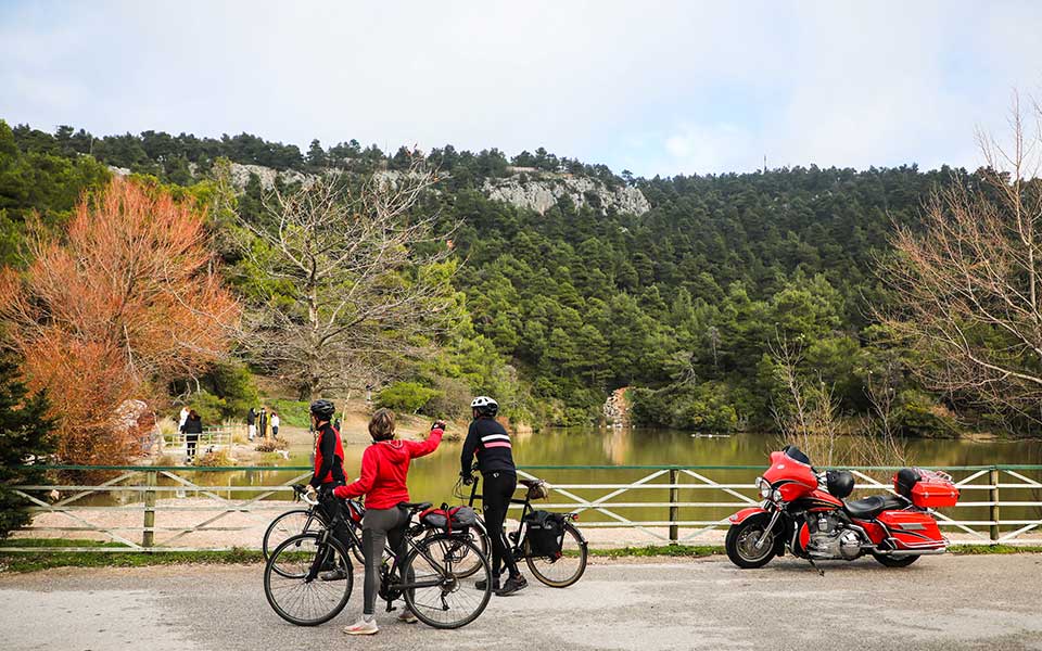
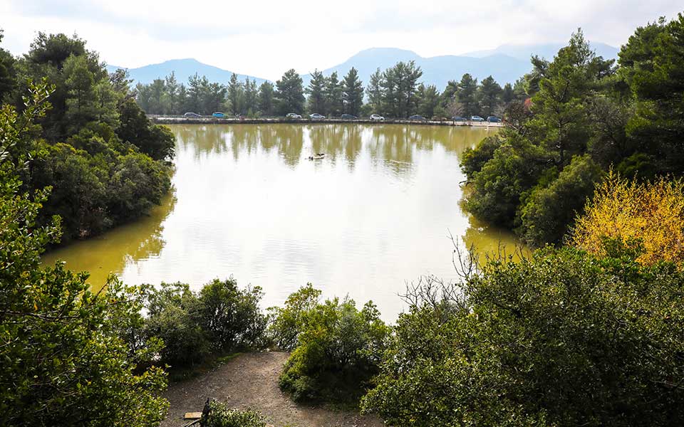
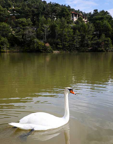
Lake Beletsi, which can be reached from Varibombi to the south or Afidnes from the east, boasting green waters surrounded by verdant slopes, is not exactly what one expects to see here at a elevation of 600 meters. This small lake sits in a peaceful landscape, where everything seems still, except for the occasional duck, goose or swan slowly cruising over the quiet waters. A handful of hiking routes start from here.
The lake was constructed over the years 1973 to 1975 as a water collection site for road projects carried out in the area, and as a future wildlife habitat. Its existence necessitated changes to the route of the road that would eventually connect Aghios Mercourios with Afidnes; in fact, some say that the lake was created more or less by accident during the construction works for that road, when the natural flow of spring waters in that area and the runoff from rainwater were blocked and the lake was formed.
© Nikos Kokkalias
The lake, which is 130 meters wide and 9 meters deep, is also called Kithara (“Guitar”) because of its shape, although it shouldn’t be confused with the other manmade lake, also called Kithara because of its shape, which was created at a point further south towards the end of the 19th century, as part of the development of the Tatoi Estate on behalf of King George I.
Migratory birds rest on its banks, while carp, eels and turtles swim in its waters. The turtles are red-eared sliders, also known as red-eared terrapins – a species sold as pets all over the world. When released – or rather abandoned – in the wild, they manage to survive in water habitats.
At the lake you’ll find families with young children busy feeding bread to the swans, ducks and carp, or couples perched on the rustic fence. People pose for photos and upload them at once to Instagram, while cyclists who chose to make the lake the goal of their ride (Parnitha is full of cyclists, walkers and hikers) dot the landscape as yet another part of this human mosaic.
There’s a contradiction about all this which is common in many popular nature destinations: the busy atmosphere of an urban park prevails in what here would otherwise be a deserted, wet and cold mountainous area.
© Nikos Kokkalias
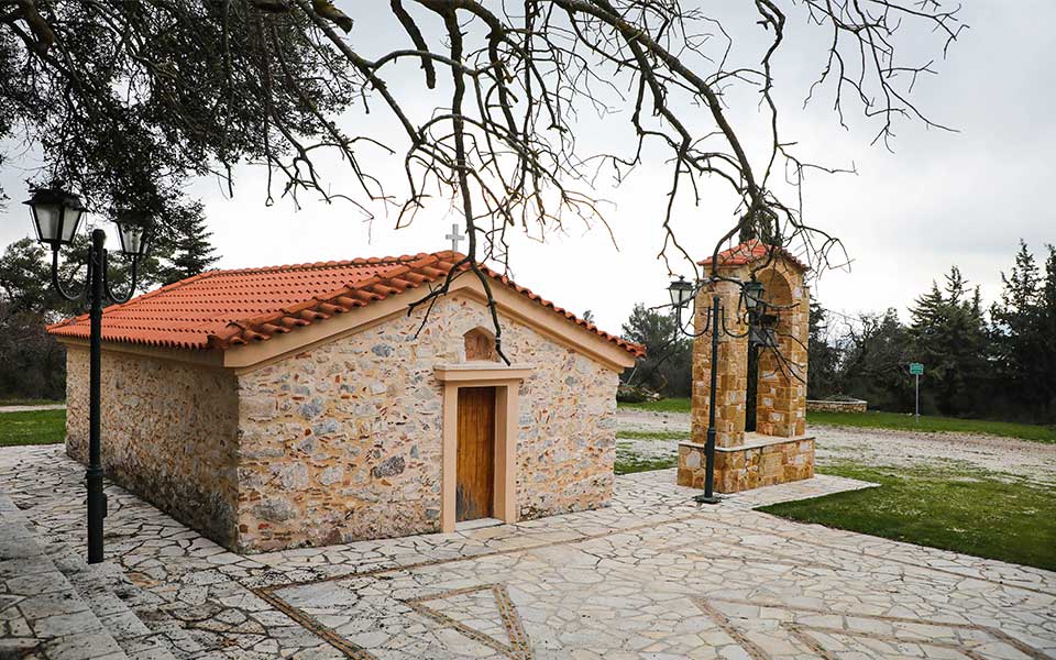
Not that Lake Beletsi is in the middle of nowhere, at least not completely. It lies at the heart of the sparsely built forested settlement of Aghia Triada, which formerly bore the name “Hippokratios Politeia” – this designation can be seen on the street signs. The lake was created before the forested area of 763,600 acres was given to the Health Building Cooperation. The road plan was approved in 1977. “Hippokratios Politeia” was renamed Aghia Triada in honor of the recently restored old chapel, located in the area.
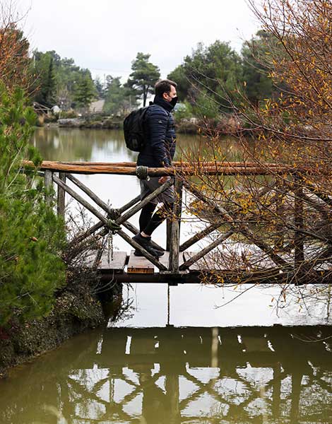
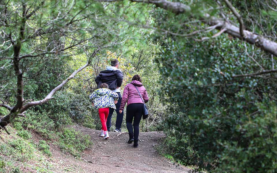
Around the lake there are a number of paths, dirt roads and country lanes. One relatively short route starts from Lake Beletsi and ends at Aghia Triada, passing for the most part through an area of dense vegetation.
Start by heading uphill on Kirkis Street. After 150 meters, the small asphalt road stops and an uphill path through the forest starts. In some places, it is marked with red paint. Two hundred meters along this path is a dirt road; turn right onto it and continue through the pine forest – the wet red soil is full of pine needles and acorns.
Five hundred meters on, the dirt road meets an asphalt road. Follow that downhill for another 500 meters, cross Asklipiou Street and then turn left on Kiouri Street which continues as Kratsa Street. After 300 meters, we turn onto Aghia Triada Street, which leads us, after another 300 meters, to the clearing with the chapel.
© Nikos Kokkalias
© Nikos Kokkalias
The green of the forest soothes the eyes
The paved area in front of the chapel, which fills with people every Whit Monday, is empty most other times. All around is the forest: pines, oaks, fir trees, plane trees, cedars, ostryas, wild olive trees, redbuds, wild mulberries, maples, arbutus, myrtles and spruce.
It’s quiet enough to hear the rush of the water from the streams of the area – in Parnitha, 45 permanent springs have been recorded – which, during ancient times, fed Hadrian’s aqueduct but are now mainly used for local irrigation. In bygone days, these gurgling underground waters passed under the Kifissos River and ran down to Hadrian’s Reservoir in Kolonaki, which was still in operation until 1940.
© Nikos Kokkalias
In the distance, far away among the foliage of the trees, sparkles the silver surface of Lake Marathon. All around are green valleys and ravines, craggy ridges and some of the sixteen peaks of Parnitha. Far away and yet clearly visible lies the Attica basin.
Up here, it’s another world, with a climate different from the capital’s sweet dry one. It’s colder and wetter, with twice as much rainfall in the upper zone of the mountain, and fog and frost are, during autumn and winter, more common than not. These eastern slopes of Parnitha in particular have always been more prone to precipitation, with 110 days of rain and 22 days of snowfall on average annually.
The air up here, light and clean, is a reminder of why Mt Parnitha, the highest mountain of Attica, was chosen as the site for a sanatorium, which opened in 1914 and remained in operation for over three decades. The poet Giannis Ritsos was hospitalized there for seven months over the period 1937-38.
There are flowers, too; the soft mountain soil nurtures lilies, crocuses and bells. In fact, the flora of Parnitha includes more than 1,000 different plant species.
To return to Lake Beletsi, continue along Aghia Triada Street for 400 meters and turn right on Kirkis Street. After 100 meters, you’ll find yourself in front of the lake again.
This article was first published in Greek on www.kathimerini.gr


