A walk through familiar places can still be exciting if it you look at it through a different lens. Recently, I stumbled upon an interactive map, created by the water company EYDAP, which takes its users on a journey along Athens’s water networks.
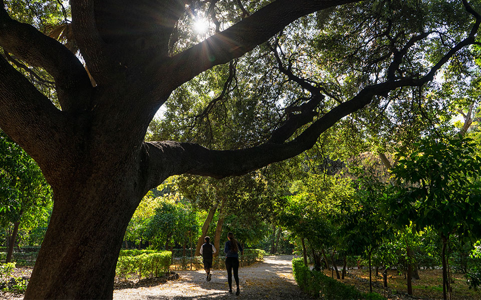
The National Garden, Ardittou Street, and Vasilissis Amalias and Vasilissis Sofias avenues all join up, water-wise, to form a route where each stop is a bridge to the city’s past. Starting from EYDAP’s public water fountain at the start of Ermou Street, we fill our water bottles and then head up to Othonos Street.
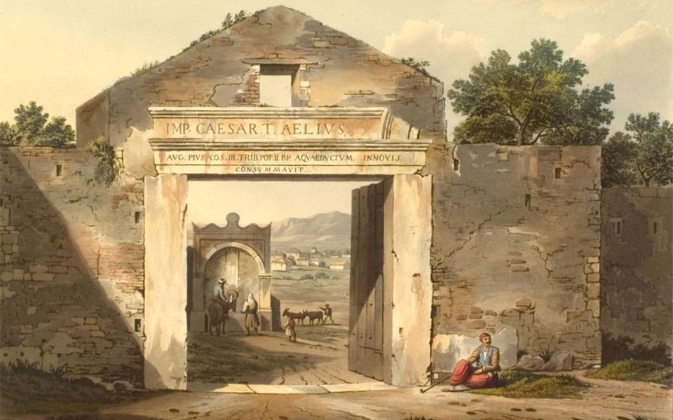
At the intersection of Othonos and Amalias once stood the Boubounistra Gate, part of the Haseki Wall which protected Athens in the 19th century. Nothing remains of the gate at this spot today, but we know what it looked like from a sketch by the Irish traveler Edward Dodwell (1805).
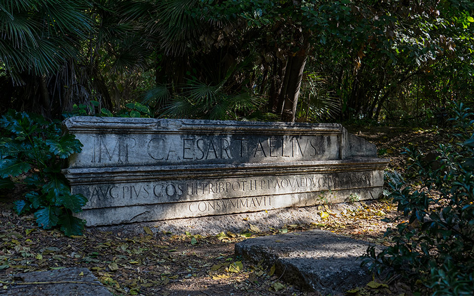
The gate took its name from the spring waters that “thundered” (“boubounizo” means “to thunder, to make noise”) down from the district of Ampelokipi. It was built with reused architectural remains from ancient buildings, among them the marble pediment from Hadrian’s cistern that can still be seen on Lycabettus Hill.
Part of that reused material is now “hidden” in the National Garden, where we will seek it out a little later.
© Marika Tsouderou
© Marika Tsouderou
We head to Vasilissis Sofias Avenue. The northern entrance to the National Garden, which leads to an area of ancient mosaic flooring that, according to one interpretation, was once part of a Roman bath, is temporarily closed for maintenance, so instead we go into the grounds from the entrance on Irodou Attikou Street.
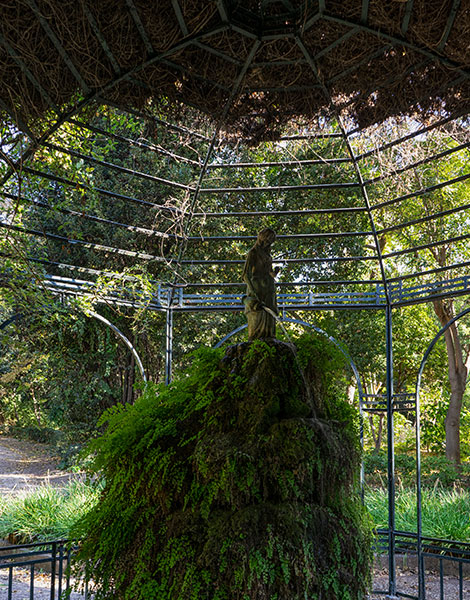
After passing the café area and the zoo enclosures, we turn right after the duck pond to pause at an iron umbrella-shaped pergola, where there was once a operating well. Beneath the Garden lies the route of the ancient Peisistratid Aqueduct, which – though now largely blocked – is said to still deliver a small amount of water to the disused well.
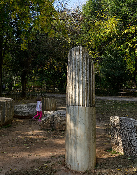
We continue in a southward direction, crossing paths with runners and walkers, as we take part in a little private “treasure hunt”: in a hidden corner, surrounded by dense vegetation, behind the bust of the benefactor Jean-Gabriel Eynard, we discover the pediment from Hadrian’s cistern, with its Latin inscription partly intact.
© Marika Tsouderou
© Marika Tsouderou
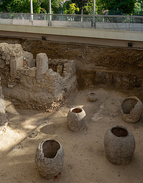
Exiting back onto Vasilissis Amalias Avenue, we stop at the site of the Roman Baths (late 3rd C.). Parts of the baths are located within the National Garden alongside the avenue, and were uncovered during the construction of a ventilation shaft for the Athens Metro.
From Vasilissis Amalias, we turn onto Vasilissis Olgas where, facing the columns of the Temple of Olympian Zeus, we cast our thoughts back to 1931, when the first modern water system, fed by the reservoir created by the Marathon Dam, was inaugurated in Athens. Back then, among the ruins, an exhibit was installed with a water fountain so high that, as accounts from the time put it, “Zeus would be angered to see it reach above the columns of his sanctuary”.
This was also along the route of the sea water network created by Ulen, the US company responsible for building the waterworks used for washing the streets and supplying the public baths.
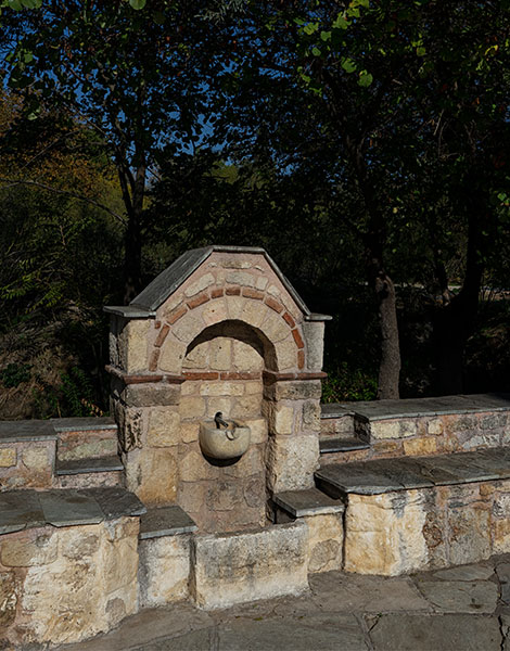
Heading along Vasilissis Olgas towards Ardittou Street, we learn that the fountain we can see in the grounds in front of the Zappeion Hall, constructed to mark that official 1931 water network opening, was the first fountain to grace Athens.
Turning right on Ardittou and heading past the old Olympic swimming pool, we come to a rock outcropping that partly blocks the sidewalk. This is no ordinary rock, but part of a sanctuary once dedicated to the god Pan.
Here, near the Chapel of Aghia Fotini, where the ground slopes downwards, is the location of the old spring of Callirhoe, where the daughters of Athens collected water for their wedding baths. Rising among the trees are the triple arches of the Ilissos Bridge, a work completed by King Otto, which now lies beneath Athanassiou Diakou Street.
This is where our route ends, on a busy road standing atop a piece of Athenian history that has been rather unfairly neglected.
© Marika Tsouderou
Watering the National Garden
The underground waters of central Athens, fed by the Ilissos and Iridanos rivers, the ancient Peisistratid aqueduct and the Ottoman-era Tsakoumakos network, were all drawn on extensively for the development and irrigation of the National Garden under the oversight of Queen Amalia.
This did not go unnoticed, as water resources at the time were scarce. It is said that the water supply to the city was even interrupted in order to water the gardens, something which provoked strong protests. As a French author of the time, Edmond About, noted: “The Athenians suffer, but the greenery is very healthy.”
© Marika Tsouderou
Making connections with the “Peoples’ Water” app
The “Peoples’ Water” app was designed in 2017 by EYDAP as part of the Greek entry for the inaugural Seoul Architecture Biennale. It is the result of a collaboration between three departments within the water company in order to showcase the company’s rich historical archive and highlight landmarks from different eras. The app allows users to choose locations on the map and see, through digital images from the archive and contemporary photos with explanatory text, in what way they are connected.
It is something that, with further development, could become a very useful educational tool, shedding light on the history of Athens through its water networks.
“It’s important to be able to understand the city through its relationship to water, a relationship which today is mostly hidden from view – until we get to the sea. This is why we created this app – because, while in reality the historical and modern water networks are not [physically] connected, it’s the nature of networks to join together places and situations”, explains Giorgos Sachinis, EYDAPs head of New Activities.
“Clicking on two different points on the map, we create a dialogue. This was the central idea behind the app: for the water networks to become networks of ideas, to take us all one step further in our thinking.”
This article was first published in Greek on kathimerini.gr


