The route
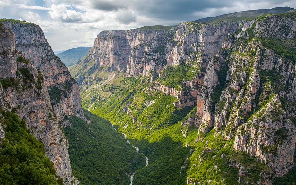
The Vikos Gorge in the Epirus region of northwest Greece is one of the most particular gorges in the world thanks to its dimensions. With a depth of 1250 meters, it has been named the deepest canyon in the world, but only when considered in proportion to its width; the narrowest part according to the North Pindos Natural Park measures just 200 meters. Additionally, since the Vikos Gorge is a UNESCO Geopark and an Absolute Protection Area, any type of activity is forbidden (staying overnight, cutting flowers, lighting fires, etc.).
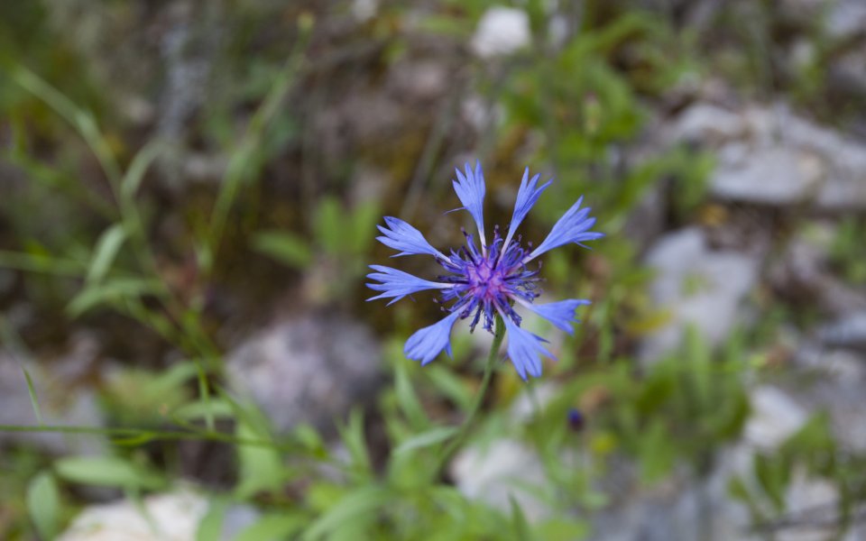
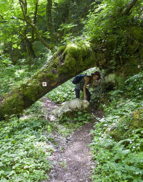
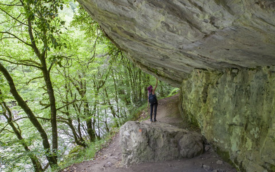
In terms of crossing the gorge, the route features inclines and descents, as well as level sections. The route takes you through thick vegetation, sometimes on pathways along the rock face, sometimes on old trails and sometimes along the river, under the impressive limestone rocks with views towards the peaks of Mount Tymfi. Listen to the birds and insects around you, pass underneath natural rock awnings, traverse dense forests where sunlight struggles to penetrate, always aware of spotting any bears, and observe the hearty seasonal herbs and flowers. The park’s natural landscape is so rich that over 1800 plant species and 186 different bird species have been recorded here.
The classic route begins at Monodendri and terminates at Vikos village, or vice versa, yet there are many variations to choose from. We set off from Megalo Papigo village and finished at Monodendri, which certainly took longer but we enjoyed the route at the foot of the imposing Astrakas peak.
© Orestis Mitrou
The stops
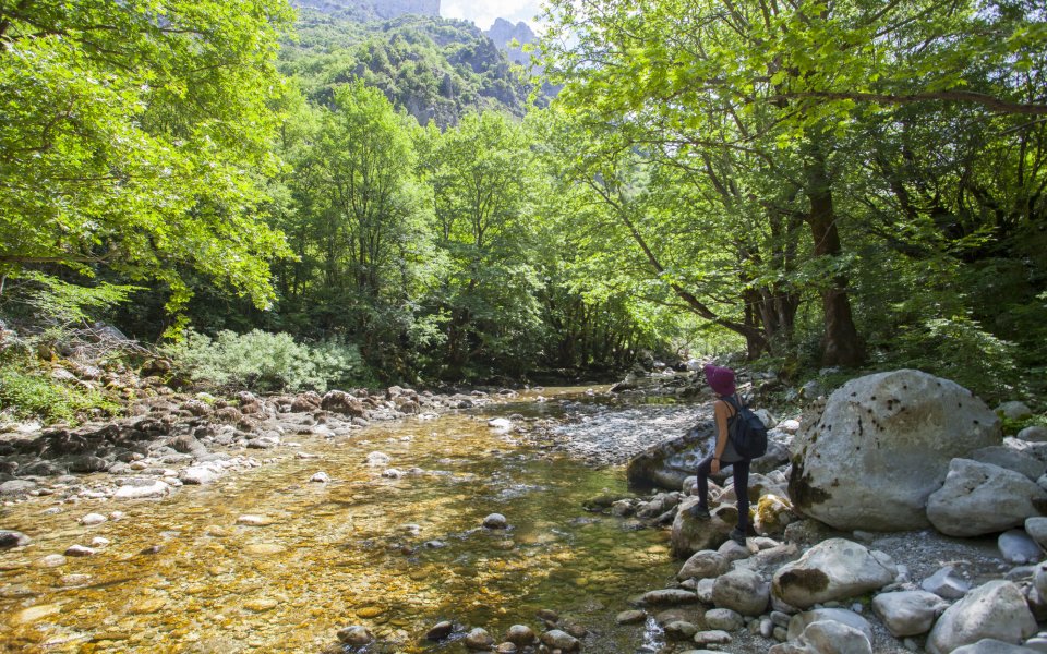
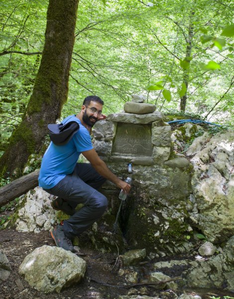
It is possible to make a stop almost anywhere on the Vikos Gorge, since there are many shady level areas. One of the most beautiful can be found in the springs of the Voidomatis River, about 2 hours after Papigo (once you arrive near the riverbed, you will need to walk a short distance in the opposite direction). This is the source of the famous river, and even though locals will encourage you to drink directly from the river, keep in mind that swimming is not permitted in the National Park. If you attempt the route before the first rainfalls, this is the only place you will find water. But be careful in case of rain, as the limestone rocks can be very slippery.
Making a stop at the Klima spring is also a wonderful option. Located halfway, be sure to fill your water bottles at the natural spring there. A final stop awaits at the Megalos Lakkos intersection, for amazing photos with the highest and narrowest section of the gorge in the background.
© Olga Charami
© Olga Charami
© Orestis Mitrou
Myths and legends
St. John’s Wort for burns and wounds, or large yellow foxglove for the heart: the Vikogiatri or Kombogiannites were the famed 17th century local healers who were revered, but also doubted. They wandered around the villages with their staffs, and sold their herbs to the locals, healing a plethora of diseases and ailments. Of course, they were not called Vikogiatri (doctors of Vikos) by chance. The herb potions they sold were exclusively sourced from the Vikos Gorge, a veritable covenant of medicinal herbs, many of which are still used today in alternative medical practices.
Target audience
The route is considered difficult even though there are no technical difficulties as it includes many hours of hiking, parts of which are not suitable for all, and rather difficult for children. Do not underestimate it. In case you need to quit, exiting the canyon is fairly limited.
© Orestis Mitrou
Tips
Terminating at Kapesovo village rather than Monodendri is a lovely alternative route, which will take an additional 1.5 hours. If you set off from Vikos rather than Papigo, calculate one hour less. In any case, follow the signage for the O3 national hiking trail, even though getting lost or going off course is very unlikely. There is a useful information center in Megalo Papigo village.
There are two viewing platforms on the trail that are worth visiting, either before or after the crossing, as they both boast amazing views of the gorge at its narrowest points: at Oxia after Monodendri and Beloi at Vradeto.
Duration
The trail measures 12 kilometers in length and can be completed in approximately 7 hours, depending on your pace and any stops. From Papigo village at an altitude of 1,000 meters you will descend to 500 meters in the gorge, before ascending to 1,060 meters at Monodendri. Be sure to arrange your return to base in advance – the distances in Zagori are no joke.


