The route
The trail from Kokkinogia to the edge of Cape Tainaron is perhaps the most interesting hike in Mesa Mani (Inner Mani), as it encompasses all the imposing charm of the Maniot landscape. In fact, the starting point of this trail was considered by the ancient Greeks to be the entrance to the Underworld, as the location also housed a necromanteion (temple of necromancy) where the ancients communicated with the dead.
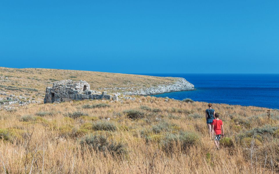
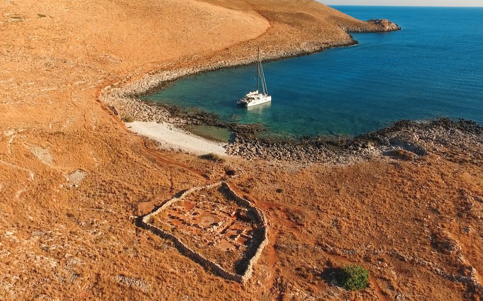
The path begins at the end of the Aeropoli-Tainaro road on the western bay of Porto Sternes, beside the Byzantine Agion Asomaton Church that is built with materials taken from the Temple to Poseidon at nearby ancient Tainaron. Approximately 300 meters in, the path passes by the ruins of the ancient settlement, a well-preserved Roman mosaic and the beautiful Aria beach. The landscape is dotted with dry stone walls and low shrubs, thorny berry bushes, thyme and oregano. The views over Porto Sternes gulf and the sea is magical, and remains visible throughout the hike.
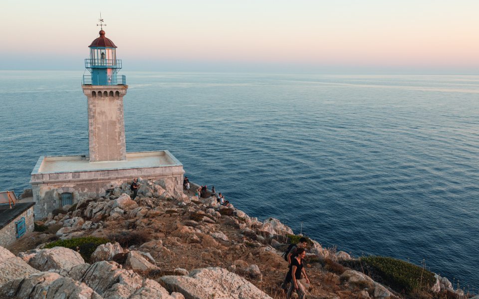
The well sign-posted and easy path continues slightly uphill over the low, ash-yellow hills and, in some places, is strewn with ash-grey and white colored flint stones, smooth and weathered by the sea salt, sun and wind. Heading uphill to an altitude of 70 meters, the route traverses a small col and, going downwards, leads directly to the Cape Tainaron Lighthouse.
Thanks to the sailors, the cape still preserves its ancient name – Matapas – which comes from the Doric phrase “Metepea Akra” (promontory between two seas) since it is located between Laconian and Messinian Mani. This is the southernmost point of the mainland Balkan Peninsula, the southern edge of the Peloponnese; many years ago, it was considered the edge of the Upper World.
© Visualhellas.gr
The stops
The absence of adequate shade along the route limits the number of stops. In addition to the archaeological site of Tainaron near the starting point and the lighthouse itself, it is also worth visiting the Roman mosaic and Aria beach for a quick swim, weather permitting. This is also the end of the uphill route, for panoramic landscape views.
Myths and Legends
The Porto Sternes gulf acquired its name from the ancient settlement’s sculptured rocks, which Maniot fishermen thought were underground tanks (sternes in Greek).
The ancient temple of necromancy of Tainaron may have been a cave, hole or underwater tunnel. The famous cave of Hades may not actually be located here, but Maniot fishermen will indicate a hole in the rock on the western part of the peninsula that is considered to be the entrance to Hades. The sculpted remains of halls and holy buildings can be found on the beach where they moor their boats. The only visible part is the sculpted canal on the east side of Porto Sternes, which, according to 2nd century AD traveler Pausanias, was the course taken by the souls of the dead on their way to the Underworld. This is also the location of a wonderful rockpool.
© Olga Charami
© Olga Charami
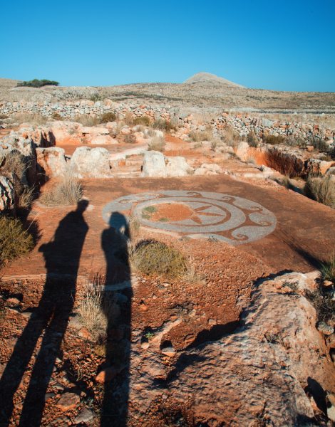
The god Poseidon was worshipped at Porto Sternes and the famed Temple of Poseidon dates from the Classical period. Much earlier, the Sun god was worshipped in a cave-adyton. The necromanteion and the oracle at Tainaron were in operation until Roman times, as evidenced by the beautiful Roman mosaic with the undulating curves. In fact, local fishermen call it the “Star of Aria.”
The Cape Tainaron (Matapan) Lighthouse was constructed by the French in 1882, standing 25 meters above the sea. It began operating in 1887 under the auspices of the Lighthouse Services. Its façade features well-sculpted cornerstones and a characteristic rim supported by small arches. The tower is square-shaped, measures 16 meters in height and initially operated a Sautier Lemonier mechanism with a rotating dioptric mirror, constructed in Paris in 1882. It had a beam distance of 16 nautical miles and could illuminate up to 41 meters above the water. From 1984 it operates as an automated, unmanned lighthouse with a beam distance of 22 nautical miles.
© Shutterstock
Target audience
The trail is accessible for novice hikers, but perhaps not for young children during the warmer months, as the absence of shade along the route may prove tiresome.
Tips
The hardly discernible path on Spakoto ridge, before the lighthouse, heads northward through a landscape filled with sage and thyme bushes, reaching the small settlement of Mianes, featuring a few old, stone houses and the quaint chapel of Agion Theodoron. In addition to good hiking shoes and plenty of water, a wide-brim hat is an absolute necessity as there is not an inch of shade to be found anywhere.
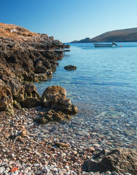
Note that the pebble beach under the Asomaton chapel and next to the ancient sculpted halls has particularly cool waters, even in the middle of the summer.
Duration
The route to the lighthouse is 2.2 kilometers in length and does not features any significant changes in altitude. Without any stops, the hike should take about 50 minutes.


